
rivers Mediterranean
Türkiye
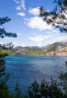
The Mediterranean coast of Türkiye offers year-round sunshine, a translucent turquoise sea and golden beaches. But it is much more than just a sea and sand holiday destination: this region has a rich history, including many ancient cities and civilisations that are thousands of years old. Add to this an unparalleled natural beauty with snow-capped mountains, majestic rivers, extensive forests of pine and cedar and deep canyons and you can begin to understand the enduring attraction of this wonderful region!
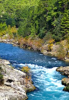
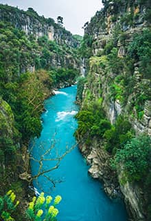
Flowing from the splendour of the Taurus Mountains into Mediterranean Sea! Mediterranean Türkiye has many rivers both substantial and small. Sometimes their course turns them into impressive waterfalls. These natural water resources offer the opportunity for cooling-off, for trying water-activity sports and for getting away from the noise of the city. Here is a list of just some of these rivers: Seyhan, Ceyhan, Göksü, Köprülü River, Eşen River, Demre River, Düden River (and, of course, the Düden Waterfalls), Manavgat River and Aksu River…
Eşen River
The 120 km long Eşen River (the river was known as Xanthos in ancient times), crosses right through the middle of the Seydikemer region. It gives the ancient city of the same name (Xanthos) its unique natural beauty. Starting at Saklıkent Canyon, the river offers the opportunity of doing rafting or tubing in most seasons! The river is also suitable for other water sports such as canoeing.
Xanthos was a city in ancient Lycia, and the site of present day Kınık, although in early sources Xanthos is used synonymously for Lycia as a whole. The archaeological site of Letoon is located between the towns of Kaş and Fethiye, approximately 4km south of Xanthos along the river. These sites illustrate the blending of Lycian traditions and ancient Greek influence, especially in their funerary art.
Perched on the sea, by the mouth of the Xanthos River and surrounded by rolling green hills and valleys, Patara was and remains an idyllic location. The city boasted a natural harbour, and its fate was tightly intertwined to the sea, its tides and currents. These tides brought to Patara great thinkers, leaders and spiritualists of the day, a trend that is continued in today’s Patara, as visitors from all walks of life come to explore the city.
Köprülü River
(lit. Bridged River) also known as Köprüçay
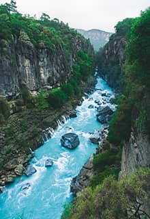
The Köprülüçay (alternatively Köprüçay, ancient Eurymedon) is a river that is situated in Antalya Province, Türkiye, and empties into the Mediterranean. The river flows into the Mediterranean near Serik through narrow and deep canyons, rising from the Taurus Mountains near Köprüçay, Isparta Sütçüler. The basin area is 2,357 km2, annual water flow is 3065 hm³, its length is 178 km and the altitude at its source is 2,151 m.
In ancient times its name was Eurymedon and it figures prominently in ancient history. At its mouth, in the 460s BCE, the Athenian general Cimon defeated a large Persian force of ships and men moving westwards (The Battle of the Eurymedon). The two land and sea battles lasted one day and included Cimon's capture or destruction of the entire Phoenician fleet of 200 triremes. In 190 BCE, a Roman fleet led by Lucius Aemilius Regillus defeated the Seleucid fleet of Antiochus III the Great, led by Hannibal, near the river. Strabo records a lake he called Caprias near its mouth although the area is today a salt marsh.
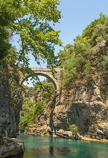
The Seljuk-era Eurymedon Bridge, which rests on Roman foundations, crosses the river at Aspendos. Further upstream, half-way on the road to ancient Selge, another Roman bridge spans the Eurymedon valley.
Nowadays it is best known as one of Türkiye’s top locations for White-Water Rafting.
Manavgat River
Manavgat is situated to the east of Antalya city. The town occupies both banks and the lower reaches of the Manavgat River.
The Manavgat River originates on the eastern slopes of Western Taurus Mountains in Türkiye and flows south over conglomerated strata for about 90 km, then over the Manavgat Waterfall and though the coastal plain and into the Mediterranean Sea. There are many caves in the river watershed area, the most interesting being the Altınbeşik cave. The maximum flow of the Manavgat River is 500 m³/second, with an average of 147 m³/second. There are two dams over the river: Oymapınar Dam and the Manavgat Dam.
The town of Manavgat is the most important location on the River. The centre of Manavgat is approximately 3.5 km from the coast of the Mediterranean Sea. The north of Manavgat is covered with dense forests and surrounded by the beautiful Taurus Mountains.In the fruitful lowlands, there grow lots of varieties of fruits, vegetables, crops and flowers. The Manavgat River is teeming with Carp, Salmon Trout and Fresh Water Crayfish. The Big Waterfalls and the Small Waterfalls of the Manavgat River are very popular both for domestic and foreign visitors.
Seyhan River
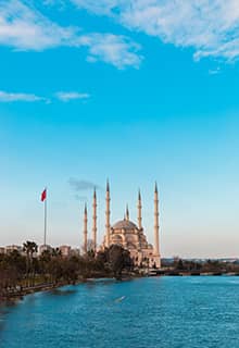
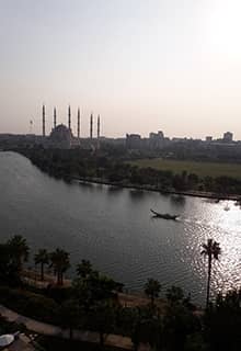
The Seyhan River is 850 km long. It rises from the central Taurus mountain range south of Sivas, passes through Adana province and then empties into the Mediterranean. Seyhan River has two major tributaries: the Zamanti and Göksu rivers. There are several hydroelectric dams on the river; Yedigöze, Çatalan and Seyhan dams. Like the Ceyhan river, Seyhan is also used for the irrigation of the cotton fields in Çukurova. Today, there are plans and talks about exporting the excessive waters of these two rivers to some countries in the Middle East, especially to Israel and to Jordan.
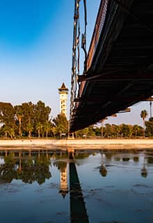
The best place to enjoy the Seyhan River is Adana. In the north of the city, at the Seyhan Dam and Lake, are shady walks, quaint tea gardens and restaurants set in cool spots where you can escape the heat. At sunset, look back toward the city to the peaceful, winding ruby river lined with twinkling lights. Visitors can also see the historical structures at the city centre that shed further light on history. The 310m-long Taşköprü (Stone Bridge) built by Hadrian and repaired by Justinian spans the Seyhan River which bisects the town; only 14 of the bridge's original 21 arches still stand.
Ceyhan River
The Ceyhan River, which was called Pyramos in ancient times, is 509 km long. It rises near Elbistan in the eastern Mediterranean region, passes through the Taurus mountains, near Kahramanmaraş, and through the Adana - Çukurova region where it's used for the irrigation of the cotton fields, and then empties into Iskenderun Bay in the Mediterranean. Its headwaters are the Sögutlu and Hurma Rivers, and its tributaries are Aksu, Çakur, Susas and Çeperce streams. The water flow at Ceyhan river is at its highest between November-December because of the rains, and in the Spring because of melting snow and its lowest between August-September.
One of the best places to enjoy the Ceyhan River is an ancient city. The ancient city of Misis is located on the banks of the Ceyhan River (antique Pyramos) on the highway between Adana and Ceyhan. The history of this ancient settlement, called Yakapınar today, goes back three millennia to the Hittite Period when the city was built on the primary military and trading roads. The nine-arched Misis Bridge across the Ceyhan River was built in the 4th century CE during the Roman Era and the Misis Mosaics Museum houses mosaics found in local excavations.
Asi River (Ancient Orontes)
The Orontes or Asi River is a 571 km long river in Western Asia that begins in Lebanon, flowing northwards through Syria before entering the Mediterranean Sea near Samandağ in Türkiye. As the chief river of the ancient Levant region, the Orontes was the site of several major battles. Among the most important cities on the river are Homs, Hama, Jisr al-Shughur, and Antakya (the ancient Antioch, which was also known as "Antioch on the Orontes"). Antakya lies on the banks of Asi River (Orontes) on a fertile plain surrounded by substantial mountains.
Samandağ is an important seaport originally founded by the Seleucids in 310 BCE as Seleucia Pieria, although there is evidence of Epipaleolithic Period settlement at Çevlik. In ancient times, it was the port (St Paul's first voyage to Tarsus began here) for Antioch which was the capital city. The remains of a Doric-order temple can be seen. During the Roman period, the town used to be a naval base. The ancient harbour was located at the mouth of the Asi River. During the Roman period, the town was a naval base. The ancient harbour was located at the mouth of the Asi River, which constantly threatened to fill the harbour up with alluvium from the mountains. To prevent this, the Tunnel of Titus (a covered channel measuring 1,330 meters long) was built in the 1st century CE by the Roman Emperor Vespasian. Carved into the limestone cliffs near the tunnel are twelve rock tombs that date back to Roman times, the largest and most famous of which is the one known as Beşikli Cave.

